Finally. We have found some time to give you all an update of our where abouts and what we have been getting up to.
05/08/2013
After many unanticipated delays we finally got to make our start. At 4 a.m. we finally set sail. The wind was just right and the ocean was fairly calm, which was lucky since this was our first night time sail and there was no moon. Surrounded by near complete darkness, we blindly pointed the boat in the right direction keeping close attention to our navigation equipment as we headed towards Yamba. The only other light, the bioluminescence of plankton as it passed below the boat and the stars above.
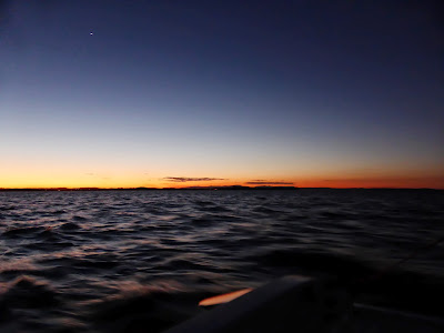
The sun started to rise just as we passed South Solitary Island.
Sadly our luck with the wind did not hold out. We experienced doldrums just after the sun had risen for about 1 hour, at midday for about 2 hours, and in the evening just before sunset, causing us to motor the last 5 nautical miles since we did not want to arrive in Yamba after dark.
 |
| The first light of dawn |
 |
| Bernd adjusting a sail |
 |
| Finally it started to get lighter |
 |
Heidrun was not able to capture the whale we saw, instead she managed to get this seagull on camera.
|
 |
| Just past the Coffs Harbour Coast |
 |
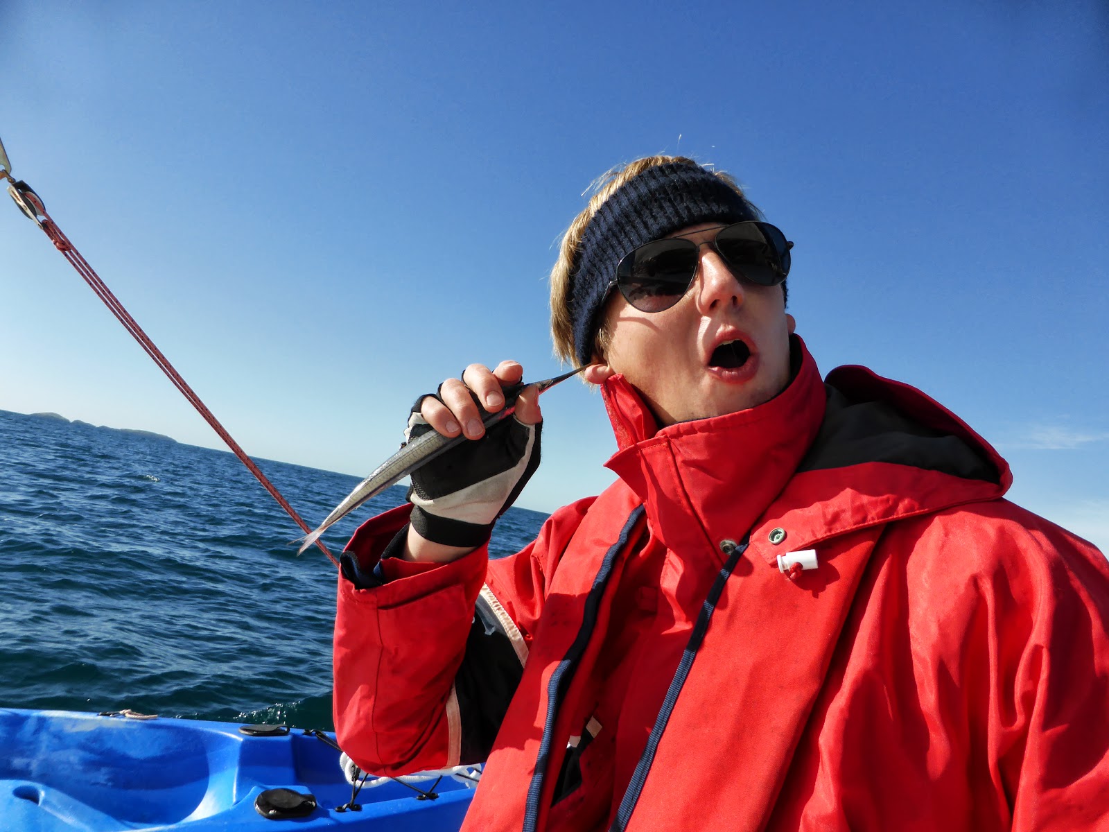
The fish that randomly decided to jump on the trampolines and die.
|
 |
| It added for some entertainment during the doldrums. |
 |
| Cooking lunch during the midday doldrums. |
 |
Lunch was Kimchi Ramen. This is when we realized that we forgot to pack some decently sized spoons. We made do with measuring cups instead.
|
 |
| Waiting for the doldrums to pass. |
 |
Finally the wind started up again and we were able to head on towards Yamba.
|
 |
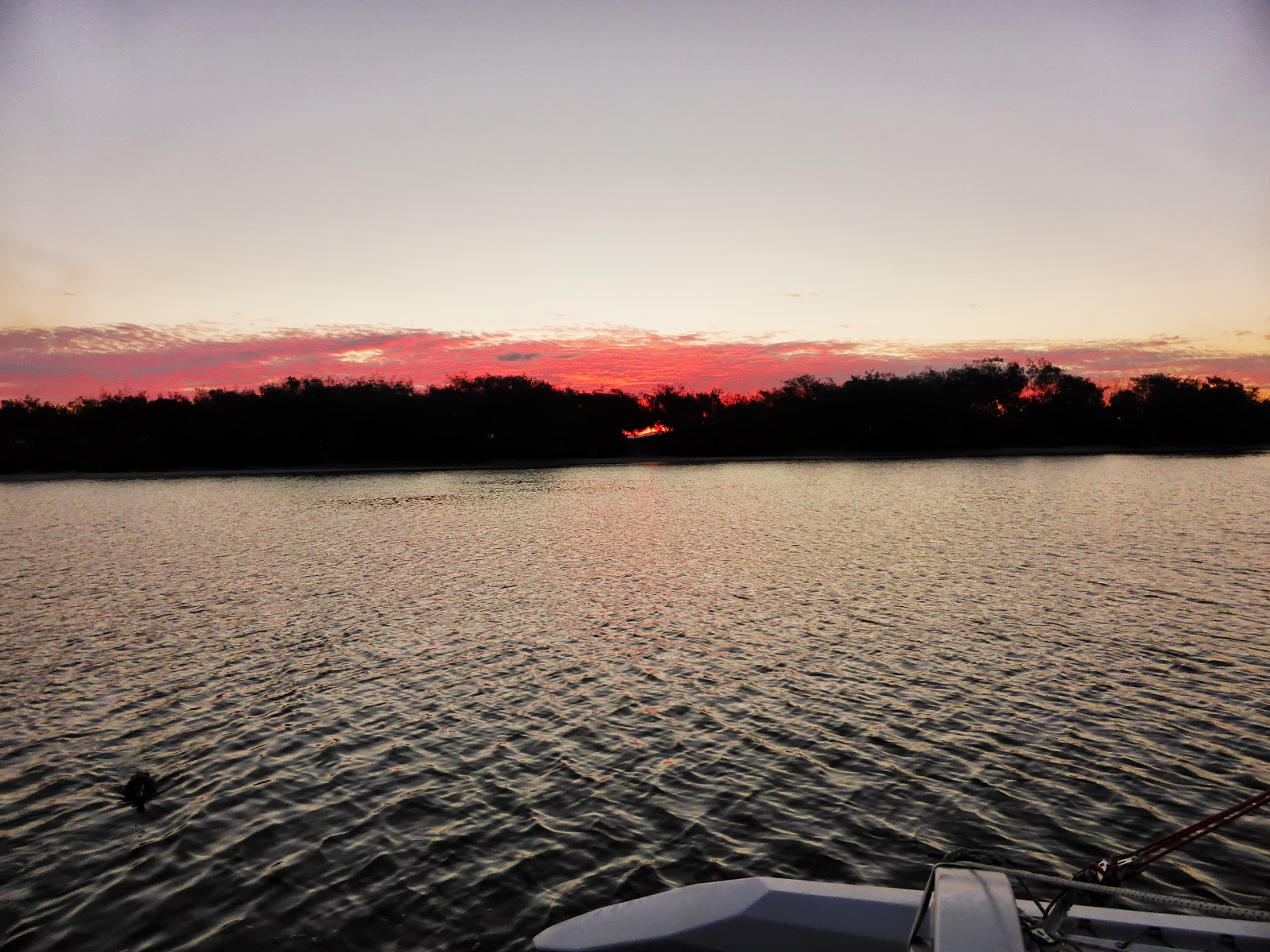
| Yamba, at sunset. |
06/08/2013
We started out at 8:30 a.m. towards Byron Bay, having realized that it was useless to start out earlier since we would sail right into the morning doldrums. We planned to arrive in Byron Bay around 4:30 in the afternoon, since the journey would take us about 8 hours at 5 knots travel speed. However, our luck was not with us. During lunch time the doldrums lasted about 3 hours. To add to this the forecast south south west winds of 10-15 knots were non existent. Instead we faced north west winds of 10 knots which slowed our progress markedly. Fifteen nautical miles before Byron Bay the wind turned more northwards which further slowed our progress. We finally set our anchor at 12 midnight, completely exhausted.
 |
| Good bye Yamba! |
 |
| Bernd attempting to catch a fish. Sadly, the only one we have caught so far was the one that jumped onto the trampoline the day before. |
 |
| Heidrun's work station. |
 |
| Bernd cooking chilli con carne for lunch. |
We finally managed to catch a whale on video. It was ca. 20 m from the boat
 |
| Sunset 15 nautical miles away from Byron Bay |
07/08/2013
We started out at around 6:30 a.m. towards Southport. Again, our luck was not with us. The predicted South winds abated shortly after they had started (around 8:40 a.m.). By that time we were already outside the Bay and caught in the currents outside the Byron Headland. Slowly we drifted backwards towards Yamba. The doldrums lasted till 13:00. Although we lost a lot of time, we got to see a lot of things instead - a pod of dolphins swam around the boat and we saw several whales. At 13:00 north winds hit us at about 10-15 knots. Since there was a storm warning for the 08/08/2013 and we did not want to be stuck in the storm we decided to pull an all nighter and tack (tacking is when you are sailing against the wind which means you have to sail at the closest angle you can get to the wind, approximately 35 to 45 degrees, and then cross back in the same fashion in order to move forward. It takes about three times longer to sail against the wind than with the wind.) up to Southport anyway. This was the most exhausting part of the trip so far, especially since we had to change sails in the dark. To ad to this the wind had picked up quiet a bit and we were stuck in a mini storm. Our tri colour light (light on top of the mast) had also decided to fail us so we couldn't even gauge the direction of the wind. Moreover, since it was a new moon we were not able to see much. We were very glad when the sun rose and we were abel to see a bit more. At 12 noon we finally arrived in Southport, exhausted to our bones. We decided to stay here for a couple of days to make some repairs and relax.
 |
| Heading out of the bay of Byron Bay |
 |
| Good bye Byron Bay |
 |
| The pod of dolphins that approached the boat and kept us entertained for a while :) |
 |
| Sunset |
 |
Finally, daylight returned.
 |
| As we glimpsed our first view of the Gold Coast a whale popped up. |
|
 |
| Safely arrived in south port. This is our anchorage spot for the next couple of days. |
 |
| Some really tame ducks that swam around the boat. |
 |
| Yet another beautiful sunset. |
10/08/2013: Gold Coast Water Ways
At 6:30 in the morning we headed towards the entryway of the Gold Coast Waterways. Sadly there were doldrums for most of the day so we had to motor most of the way. It was not all bad, however, since the Gold Coast Waterways makes for some varied scenery, so our trip through the waterway tended to be quiet interesting. About 2 hours before the start of Moreton Bay we anchored. Although we had been warned that there would be plenty of sandflies we did not experience any for most of the day, causing us to let our guard down. As we anchored we realized why people had made a fuzz about them - we quickly put up our mosquito nets and withdrew to the inside of the boat. Nevertheless we woke up with bites all over our feet.
 |
| Good bye Gold Coast |
 |
| The Gold Coast Waterways are an excellent vantage point for getting a peek at water front houses |
 |
Yet another sunken boat
 |
Heidrun's sailing gloves keep getting wet when she pulls up the anchor. This makes them rather unpleasant in the wind so she has taken to hanging them up to dry when she gets the chance.
 |
| Finally, in the last stretch before our anchorage some wind came up. |
|
|
11/08/2013: Gold Coast Water Ways to Raby Bay
We got up early to catch the morning winds and set sail towards Raby Bay, aproximately 12 nautical miles north east of the start of Moreton Bay.
Raby Bay was a very convenient stop for us since we were able to refill our water and fuel. Moreover, there was a council berth place to which we were able to dock for 2 hours, directly opposite to which was a shopping center where we could buy everything we needed to restock our supplies.
The bay itself was not the most comfortable anchorage, but given the amenities near by a passable trade off.
 |
| The Waterways have some treacherous shallows, many if which cannot be seen unless there is a low tide due to the murky water. |
 |
| The end of the Waterways, marking the start of Moreton Bay. |
 |
| The smooth water made the anchored boats look like they were floating in the air. |
 |
| Some more dolphins :) |
 |
| The last way marker to Raby Bay. |
 |
| Raby Bay. |
12/08/2013: Raby Bay to the northern end of Deception Bay
We started of at 6 in the morning and had 27 nautical miles ahead of us to reach the northern end of Deception Bay. The wind nor the waves were in our favour, nevertheless we made it by late afternoon. Unfortunately we had to cast our anchor three times, the first two times not being good anchor spots (too exposed, too shallow). At sunset (approx. 5:30 p.m.) we finally found the right spot, exhausted, hungry and cold. We decided to stay a day at this anchorage to relax. The town of Bongaree is a quaint little place with a tiny tourist information. The seniors working there were only too happy to point us in the right direction of a shopping center (we forgot some things in Raby Bay). While Bongaree is a very good anchorage with northern winds (vey calm sea, almost like being on a lake) it is not the best when the wind is coming from any other direction. Also there are some quiet strong currents, which made maneuvering with our 15hp motor quiet a challenge.
 |
| Yet another gorgeous sunrise. Heidrun has gotten a little addicted to taking pictures of sunrises. |
 |
| Bongaree, Deception Bay. |
14/08/2013: Deception Bay to Mooloolaba
We set out at 6 a.m.. We had about 29 sea miles to Mooloolaba and thought we would have to tack all day against the wind to get there. However, today our luck was with us and we had just the right winds. The anticipated 12 hours were now reduced to 7 hours of travel time.
 |
| Good bye Bongaree! |
 |
| Sailing wing on wing. |
 |
| Finally. The wind gods were on our side. Contrary to the weather forecast, which predicted a north wester wind, we had some south wind and were able to use the spinaka for a good hour or two. |
 |
| Fishing...holding a fishing line for an extended period of time gets rather tedious and boring. |
 |
| Luckily our kayak makes for a good fishing rod holder. Sadly we still haven't been able to catch a fish. |
 |
| The sea was so calm we were able to get out the solar panel to charge our batteries. |
 |
| Batteries charging. |
 |
| We just managed to escape the bad weather :). |
 |
| Mooloolaba headland |
 |
| Just as we arrived almost all of the clouds had dispersed. |
15/08/2013: Mooloolaba
Mooloolaba is surprisingly a very nice town (it doesn't look it from the outside: from the outside you can see your usual high rise buildings clustered tightly together around one overcrowded beach). Mooloolaba is probably most comparable to what Byron Bay used to be like 12 years ago (when Byron bay wasn't backpacker and schoolies central). It has the sleepy relaxed holiday feel to it that comes with a town that isn't overrun by tourists and not over commercialized. There is a beach esplanade boasting a few cheap restaurants, amongst them a sushi place :). There is a nice anchorage right in the city center. We spent our first night there. Our second night was spent at The Warf Marina, since we had to make repairs and needed to charge our batteries.
 |
| Walkway next to the beach. |
 |
| The walkway extends for a good kilometer around the headland. |
 |
| Fixing part of the trampoline which had started to come undone. |
 |
| The first method did not work so we had to undo the ropes holding the trampoline in place. |
 |
| Bernd fixing the trampoline. |
 |
| Moored at The Wharf Marina. The only berth left was a 30 m long one. Considering the trimaran is a mere 10 meters long it made us feel pretty tiny next the the power boats. |
16/08/2013: our last day in Mooloolaba
We left the marina and anchored nearby. We had a very relaxing day and went to the Twilight Markets in the evening, where we were able to buy some delicious olives :). They were marinaded with chilli, garlic, rosmary and oregano. Heidrun is going to attempt to marinade olives herself now. Hopefully they will turn out just as delicious. We went to bed quiet early since we were going to get up at 3 a.m. to sail the next long stretch. We had to get up this early because we wanted to cross Wide Bay Bar (the entry way across a sand bar to the channel between Fraser Island and the mainland) and we had to get the timing exactly right so we wouldn't get smashed by waves or have a strong current against us.
 |
| Mirrors at the markets. |
 |
We found the roots on these trees quiet interesting.
 |
| The left most boat is Kite. We paddles from her to the shore. |
|
 |
| The lamp post was ideal to secure our canoe. |
17 August: Mooloolaba to Pelican Bay
The journey to Pelican Bay was one of our longest yet (70 nautical miles in total). To add to this the journey was quiet a wet one because we had waves and swell coming from two different directions. This resulted in a wave cris cros effect, which we can assure you, doesn't make the journey more comfortable. Luckily sea sickness tablets helped us out. We had to motor quiet a bit of the way because either the wind was not strong enough or we would have come too far of the course if we had tacked the whole way, which would have slowed us down considerably and we would not have made it on time. We did have the option of anchoring near Rainbow Beach, but considering the condition of the sea weren't game enough to anchor, preferring to seek out calmer waters. Arriving around 5 p.m. we were able to enjoy an hour of sunlight.
 |
| Rainbow Beach light house. |
 |
| The beautiful sand that gives Rainbow Beach its name. |
 |
| We were quiet surprised. So many people had warned us about Wide Bay Bar, how rough the conditions would be. Instead we were faced with a smooth ride and were even able to motor sail in. |
 |
| Aided by the current we made about 11 knots and caught up to the yacht that had started the passage through Wide Bay Bar some 20 minutes before us. |
 |
| The start of Fraser Island. |
 |
| Pelican Bay. The entrance market by dozens of pelicans perched on a sand bank. |
18 August: Pelican Bay
We spent the day here, recuperating from our long taxing journey. We went for a swim at Inskip Point and walked along the beach. It was quiet pleasant. In the afternoon we headed towards Tin Can Bay to get fuel. On the way out of Pelican Bay a fisherman started waving at us madly "That way! That way! Go F&*)N that way!", pointing to his left. He had seen us coming and, despite this, had started letting out his net. The way he was pointing us would have led us straight onto a sandbank. The only option for us was to head straight on since he had already cut us of to our right, instead of waiting for us to pas. Luckily for him our centerboard was pulled up and we were able to detangle our rudder when it got caught in his net. Furious and red faced his wife yelled obscenities at us as we passed through the second part of the net. After about 2 hours of sailing we arrived in Tin Can Bay (Snapper Creek). We did not realize it was a Sunday until a fisherman told us. The shops closed early so we had to wait the night anchored in the river.
 |
| A sea turtle popped up just 5 meters away from Kite. |
 |
| We paddled here from the boat when it was low tide. The sand bank recessed as far as the brown lines in the water. We had to lug the kayak over the muddy sand banks, sinking up to our knees in mud for approximately 300 meters. It was quiet strenuous. Luckily we were able to go for a swim in the cool clean water on the other side. |
19 August: Tin Can Bay
We got up early, surrounded by fog. The ingoing tide brought hundreds of jelly fish with it, who glided past us in eery silence.
19 August: Tin Can Bay to Garry's Anchorage
From Tin Can Bay we headed towards Garry's Anchorage, some 20 nautical miles north of Tin Can Bay. It was a nice interim stop on our way to Urangan (which is situated at the start of Harvey Bay).
 |
| Home made crane? :D |
 |
| Heading out of Tin Can Bay. |
 |
| River Dolphins? These ones had a much lighter grey colour than the usual dolphins we saw out at sea. |
 |
| There was some beautiful scenery on the way up, with some beaches looking quiet enticing. |
 |
| The play of light in the clouds on that day was amazing. |
 |
| Heading into Garry's Anchorage around 5 p.m. |
20 August: Garry's Anchorage to Urangan
We set out early in the morning an made good way. Around lunch time the winds were just right to use the spinnaker. Oh the joy!. The boat sailed smoothly with minimal adjustments having to be made to the auto pilot. However, after about 1 hour the winds picked up too much. At 13. 3 knots we had to let the spinnaker fly, otherwise we would have endangered ourselves and the boat. As luck would have it the throttle cable on the motor broke as we were trying to take control of a situation going towards dangerous (sand banks pretty close on the left and right). We did the only thing that seemed safest at the time - threw out the anchor. The strong current kept the boat away from the sand banks and dug the anchor in nice and deep. After about 2 hours of trying around Bernd was able to fix the throttle cable temporarily and we were able to continue on our journey. Two nautical miles away from Urangan we anchored in a bay near a smoldering bush fire. The wind was just right so the smoke didn't bother us.


 |
| The sand looked almost like cliffs. |
 |
| The weather was so calm that we were able to dry our bedding and towels. Moisture is one of the downsides of living on a boat. If you can't ventilate every day and aren't able to put the bedding out every couple of days then everything becomes quiet damp. |
21 August: Urangan
We were able to fasten to a public pontoon in Urangan for a couple of hours to get supplies. We walked for about 30 minutes until we were able to get replacement parts for the throttle cable. Surprisingly we found the parts at a bike store. The two chandleries we called on didn't haven anything, nor did the outboard motor shop. Afterwards we walked to a shopping center where we were able to get supplies. After another 30 minute walk we cast of the public pontoon and headed out towards the lagoon anchorage.
 |
| Approaching Urangan. The long jetty you see used to be 1.5 km long to allow for tanker ships to dock. After trade slowed in Urangan the length got reduced due to high maintenance costs. |
 |
| Urangan esplanade. To the left, the harbour. |
 |
| Entering Urangan harbour. |
21 August: Urangan to Lagoon Anchorage
Our journey to Lagoon Anchorage was fairly uneventful. There was some nice scenery on the way and we saw some whales in the distance. Sadly, there was no wind. We thought it would pick up in an hour or two but it didn't. We ended up motoring the whole way. As we arrived at lagoon anchorage we had a bit of trouble finding the entrance and got stuck on shallow sand. Luckily the tide was coming in and we didn't have to wait long until we were free and could make our way in.
 |
| The ocean was so smooth because of the lack of wind. |
 |
| The ripples in the water wasn't wind. They were tiny fish moving across the water surface, occasionally jumping out. |
 |
| Bushfires loom ahead of us as we get closer to lagoon anchorage. |
 |
| Finally anchored. The bushfires made for a spectacular view. |
21 + 22 + 23 August: Lagoon Anchorage
We woke up to heavy smoke in the air. Luckily it had abated by 9 a.m. so we decided to stay the day, hoping that the bushfire would die down enough so we would be able to have a smokelness second night. We went for a paddle up one of the creeks as the tide went out, slowly dyeing the crystal clear blue water a cola brown. On our way up we passed quiet a few puffer fish. When we got back Bernd decided to try his and in fishing again. There were so many tasty looking fish at the bottom of the lagoon. However, his attempt was to no avail because puffer fish kept eating the bread of the hook, so it never made it far enough down to the bigger fish. The puffer fish were so tame that we were able to feed them by hadn. If you weren't careful they would nip at your fingers. Cheeky little buggers! On the 23rd we woke up to more smoke, so we decided to head on. We will be back though, this was a really nice place :).
 |
| The smoke of the bush fires abating, leaving a beautiful scenery in its wake. |
 |
| It seems swallows have an affinity to this boat. Everywhere we go we wake up to some perched at the front of the boat. If we stay in one spot for too long they start building a nest below one of the swimmers. |
 |
| Spot the dingo. |
A feeding frenzy commences.
 |
| Paddling towards one of the creeks entering the lagoon. |
 |
| The different shades of water was amazing - the cola brown of the creek entering the lagoon, the darker blue of the deeper parts of the lagoon and the aqua blue of the shallow parts of the lagoon. Amazing! |
Video coming soon: Heidrun feeding puffer fish by hand.
23 August: Lagoon Anchorage to Rooney Point
This was one of our better sails. We had a good wind and got there four hours earlier than estimated :).
We saw many whales on the way.
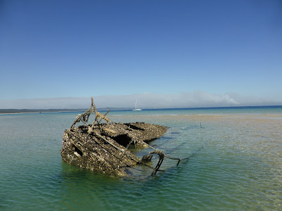
 |
| Bernd paddles to sure to investigate a shipwreck at Rooney Point. |
24 August: Rooney Point to Lady Muscgrave
We got up at 3 a.m. and set sail at 4 a.m. having 55 nautical miles ahead of us. The sea was a mess and this was probably our wettest sailing turn yet. Although we had good wind we faced some pretty high waves, much higher than the forecast 1.5 meter or less. Both feeling quesy we found out we only had one sea sickness tablet left! Ouch. Bernd being the gentleman gave it to Heidrun, who proceeded to spew it right out again. Ooops!. Just as the sun was coming up we nearly ran into three whales. We weren't able to see them in the dark. One was splayed on its back, it's belly turned towards the sun. Luckily we were able to avoid them just in time!. As we made good way Heidrun's sea sickness turned towards the worse resulting her leaning over the back of the boat every 30 minutes or so. It was a journey of hell for her. When Lady Elliot Island appeared the sea was still really choppy. We decided to head on another 21 nautical miles to Lady Muscgrave Island since we would have better protection there from the sea. We made it just as the sun set. Sorry for the lack of photos, Heidrun was to ill to muster up the strength to capture the scenery.
24 +25 + 26 + 27 August: Lady Muscgrave
On our first day here we did not get of the boat, choosing to recooperate from a very stressful journey. Our tummies still felt a little queasy. On the 25th we paddled to the island part of the reef. Lady Muscgrave is an undeveloped island, part of the Whit Sunday Islands. You can go camping here, but you have to bring everything yourself (including water), and have to be able to carry it!. There was an eldery lady stationed on the island by national parks. We thought she had a pretty good deal going: she got to stay for two weeks and they supplied her with gas and water. In turn she had to make sure tourists didn't light any fires etc. After having had a nice chat to her we went for a snorkel on the other side of the island. There were only two other people on the island, and they weren't in sight. It was like we had the whole island to ourselves. We were lucky enough to swim with five sea turtles! We then walked around the island and paddled back to our boat. We then relaxed for the rest of the day. On the 26th we paddled to oe of the snorkeling reefs around the island. Bernd had built an anchor for the kyak with a chain so we could leave it nearby while we snorkeled, which was pretty handy. In the morning of the 27th we took our leave and sailed towards pankace creeks, which was situated 35 naitucal miles north east of Lady Muscgrave Island.


 |
| Perhaps we should have brought our diving gear along after all! |
 |
| The walk through the Island was very pleasant, even if most things were covered in bird poop. |
 |
| A Black Noddy. It must have been used to people since it let Heidrun get up really close to it. It nests in pisonia trees, which can be detrimental for its young. Apparently their nests are are really sticky and their young literally become stuck and die. |
 |
| This pretty little bird is a buff-banded rail. It dwells on the ground and feeds of the eggs and chicks of other ground dwellers. |
 |
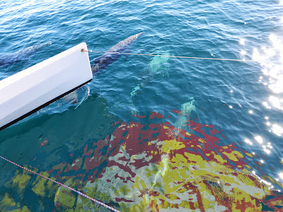
| The water at Lady Muscgrave Island was crystal clear. |
 |
| The bottom of the sea was covered in sea cue cumbers. The deeper you got the bigger they were. Some were even green or yellow. |
Video coming soon: Bernd swimming with sea turtles
 |
| Bernd swimming after a sea turtle. |
 |
| Spot the fish. This fish was so sure of it's invisibility that Heidrun could get up really close to it without it moving away. |
 |
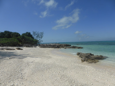
| A beach all to ourselves. |
 |
| Making pizza on the barbeque. |
 |
| The egg on the pizza wouldn't cook because there wasn't enough heat on top. Heidrun solved this by putting a pot lid over the pizza. |
 |
| This cheeky seagull sat on the back of the boat when we got up the next morning. |
 |
| Parrot fish. |